Driving Teide National Park: The Best Routes and Viewpoints
Aggiornato il 10 novembre 2026 · DoTenerife
Questa guida non è ancora disponibile nella tua lingua, quindi viene mostrata in inglese.
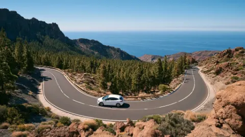
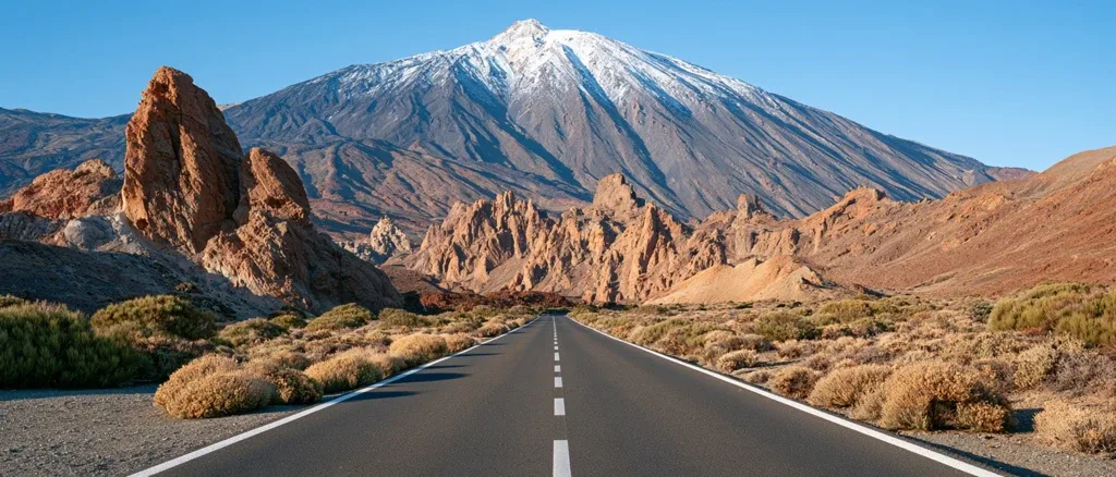
Teide National Park is Tenerife’s top day out by car and free to enter. A UNESCO World Heritage Site since 2007 and Spain’s most visited national park, it surrounds Mount Teide (3,715 m), the highest point in Spain, and the vast Las Cañadas caldera. Four main roads climb into the park: the TF-21 from Vilaflor in the south, the TF-21 from La Orotava in the north, the TF-24 from La Laguna along the La Esperanza ridge, and the TF-38 from Chío on the west side. The best stops are Roques de García, Llano de Ucanca, Minas de San José and the Narices del Teide. Allow a full day, fill up with fuel first and pack warm layers, because there are no shops and it’s much colder up there.
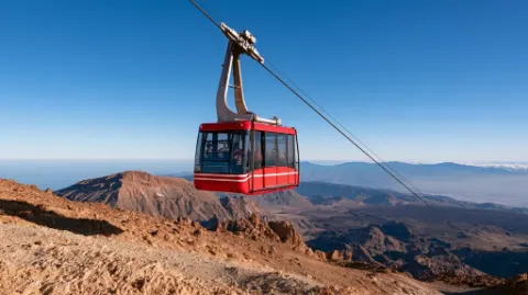
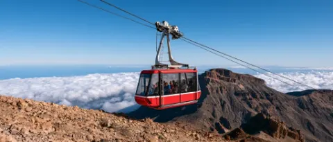
This guide covers the drive and the viewpoints. For the cable car, summit permit and hiking up the volcano, see our Mount Teide guide and Teide cable car guide.
The four roads into the park
| Road | Starts from | What it’s like |
|---|---|---|
| TF-21 (south) | Vilaflor, above Los Cristianos and Costa Adeje | Climbs through Spain’s highest village and pine forest; the best route from the southern resorts |
| TF-21 (north) | La Orotava, above Puerto de la Cruz | Winding climb through farmland and forest to El Portillo |
| TF-24 | La Laguna, via La Esperanza | Ridge road with views over both coasts and the sea of clouds; passes near the Teide Observatory |
| TF-38 | Chío, near Guía de Isora and Santiago del Teide | Links the west coast to Boca de Tauce; passes the Narices del Teide lava flows |
Inside the park, the TF-21 runs across the caldera floor between El Portillo in the north-east and Boca de Tauce in the south-west, where it meets the TF-38. Most of the viewpoints are along this stretch.
The best viewpoints and stops
Roques de García
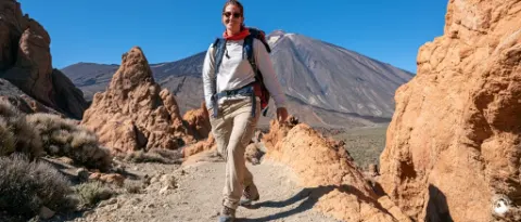
The park’s most famous stop, opposite the Parador. The rock towers include Roque Cinchado, the narrow-waisted rock once printed on Spanish banknotes, with Teide rising behind. A circular trail of around 3.5 km loops around the rocks. It’s rocky and has a steady climb at the end, so wear proper shoes and allow around two hours. The car park fills by late morning, so arrive early or late in the day.
Llano de Ucanca
Just below Roques de García, this flat plain of sand and gravel looks almost like a dried lake, with cliffs on one side and Teide on the other. The viewpoint on the road gives one of the classic wide shots of the caldera.
Minas de San José
A landscape of pale pumice and dark lava near the cable car junction, which feels like another planet. Stay on the paths; the pumice is fragile.
Narices del Teide and Mirador de las Narices
The Narices del Teide (“Teide’s nostrils”) are vents on the side of Pico Viejo that erupted in 1798. The Mirador de las Narices on the TF-38 looks across the black lava flows they produced, one of the most recent eruptions on the island.
Mirador de Chío
Lower on the TF-38, this viewpoint looks over lava fields and pine forest towards the west coast and, on clear days, La Gomera.
Corona Forestal and Paisaje Lunar
Below the caldera, the park is ringed by the Corona Forestal, a huge Canary pine forest. Above Vilaflor, the Paisaje Lunar (“lunar landscape”) is a set of eroded pale rock formations reached on foot. It’s a proper hike rather than a roadside stop, so check the route and allow half a day. See best walks and hikes.
El Portillo and the Parador
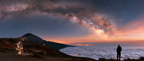
The El Portillo visitor centre at the north-east entrance has exhibits on the park’s geology and plants. The Parador de Las Cañadas del Teide, beside Roques de García, is the only hotel inside the park and has a restaurant and café, and there’s a small visitor centre next to it too. The Teide Observatory, near the TF-24, is a working research site that can only be visited on organised tours. See stargazing in Tenerife.
Suggested loop from the south
This route avoids doubling back and shows you the park from different sides:
- Leave early from Los Cristianos, Playa de las Américas or Costa Adeje and drive up through Vilaflor (around 1,400 m), Spain’s highest village. Stop for coffee and fuel.
- Climb the TF-21 through the pine forest into the caldera, entering at Boca de Tauce.
- Roques de García and Llano de Ucanca: walk the circular trail while it’s cool.
- Minas de San José and the cable car base if you’ve booked a ride.
- El Portillo for the visitor centre.
- Return option A: head down the TF-21 to La Orotava, then back along the TF-5 and TF-1 motorways. Add a stop in La Orotava or Puerto de la Cruz.
- Return option B: drive back across the caldera to Boca de Tauce, take the TF-38 past the Narices del Teide and Mirador de Chío, and descend to the west coast. Finish with sunset at Los Gigantes.
If you’d rather someone else drive, many Tenerife excursions include a Teide stop.
Weather, altitude and safety
- It’s cold. The caldera floor is above 2,000 m, so expect temperatures well below the coast. Snow and ice are possible in winter. See Tenerife in winter and the weather in January.
- Roads can close because of snow, ice, wind or fire risk. Check Cabildo de Tenerife road updates on the day.
- Sun and dry air. UV is strong at altitude, and the air is dry. Bring sun cream, sunglasses, a hat and plenty of water.
- Altitude. Most people are fine at caldera level, but take it slowly if you feel breathless or get a headache. Pregnant women and people with heart or lung conditions should take medical advice before going high.
- Driving. Roads are good but winding, with cyclists and coaches. Use lower gears on the descent. See our driving guide.
- Fuel and food. There are no petrol stations or shops in the park. Fill up beforehand and bring snacks.
- Respect the park. Don’t take rocks or pumice, don’t stack stones and stay on marked paths.
When to go
The park is open year-round. Clear mornings give the best views, and the late afternoon light is beautiful. Spring brings the red flowering tajinaste (Echium wildpretii), usually from late April into June. Winter can be crisp and clear, sometimes with snow on the summit, but check for closures. For sunsets and the sea of clouds, see sunset spots.
Information checked on 10 November 2026. Road conditions, visitor centre hours and access rules change, so check the Cabildo de Tenerife and national park updates before you travel.
Domande frequenti
Is Teide National Park free to enter?
Yes. There is no charge to drive into Teide National Park or to use the viewpoints and marked trails. You pay only for extras such as the cable car, guided tours and food. Climbing to the very summit needs a separate free permit, covered in our Mount Teide guide.
How long do you need to drive around Teide National Park?
Allow a full day. The drive itself can be done in a few hours, but stopping at viewpoints, walking the Roques de García circuit and having lunch easily fills six to eight hours, especially if you start from the south coast.
Which road is best for driving up to Teide?
From the south, the TF-21 through Vilaflor is the most scenic, climbing through pine forest. From the north, the TF-21 from La Orotava is the classic route. The TF-24 along the La Esperanza ridge from La Laguna has huge views, and the TF-38 links the park with Chío and the west coast.
Can roads in Teide National Park close?
Yes. Snow and ice in winter, and occasionally strong wind or wildfire risk in summer, can close park roads at short notice. Check the Cabildo de Tenerife road updates and the weather forecast before you set off.
Is it cold in Teide National Park?
It can be. The caldera sits at over 2,000 metres, so it is often 10 to 15 degrees colder than the coast, and much colder near the summit. In winter, frost and snow are possible. Bring warm layers even if it is hot at your hotel.
Are there shops or petrol stations in the park?
No. There are no petrol stations or supermarkets inside the park, only a few places to eat, such as the Parador and cafés near El Portillo and the cable car. Fill up with fuel and buy water and snacks before you climb.
Guide correlate